Shigatse
Updated: 2022-12-16 (chinadaily.com.cn)  Print
Print 


(1) Historical geography
In mid-13th century, Tibet was governed under the administrative jurisdiction of the central government, with Shigatse being home to 60,000 households.
At the beginning of the 20th century, the Gaxag (Tibetan name of the local government of Tibet) government renamed Shigatse as Jizong. After the peaceful liberation of Tibet, the Shigatse and Gyalze temporary working committees were established respectively in 1951.
In 1960, the Shigatse and Gyalze commissioner's offices were each established; in 1964, they merged into the Shigatse Commissioner's Office; in 1978, it was renamed the Shigatse Prefecture Administrative Office, and on June 26, 2014, the State Council formally approved the establishment of Shigatse as a prefecture-level city.
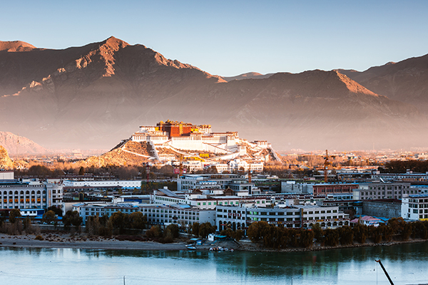
Located in the southwestern part of Tibet, Shigatse is about 800 kilometers long from east to west and 220 kilometers from north to south.
It is adjacent to Lhasa and Lhokha to the east, the Ngari area to the west, Nepal, Bhutan, and India to the south, and Nagchu to the north, and covers an area of 179,240 square kilometers, with an average altitude of more than 4,000 meters.
It also boasts the world's highest peak - Mount Everest, the world's highest "hanging lake"- Changzhi Glacier Lake, Tashilhunpo Monastery, the Gyangze Anti-British Site and other national key cultural units. There are 15 cultural relics and 131 autonomous region-level key cultural protection units.
(2) Population division
Shigatse is an ethnic minority area dominated by Tibetans. The total population of the city is 850,000, with the Tibetan population ranking first, accounting for about 89.9 percent. In addition, there are dozens of other ethnic groups in the area, including Han, Hui, Tujia, Manchu, Miao, Zhuang in the territory.
In 2014, the Shigatse area and county-level cities were abolished, and the prefecture-level city was established, covering an area encompassing the Samdrubze district, Namling county, Gyalze county, Dingri county, Sa'kya county, and Lhaze county, including 204 towns and 1,673 villages.
(3) Economic and social development
In 2018, the regional GDP reached 24.32 billion yuan, an increase of 8.9 percent over the previous year. Among them, the added value of the primary industry was 3.89 billion yuan, an increase of 3 percent; the added value of the secondary industry was some 9.51 billion yuan, an increase of 14.4 percent, and the added value of the tertiary industry was about 10.92 billion yuan, an increase of 6.5 percent.
In the total regional GDP, the primary, secondary, and tertiary industries accounted for 16 percent, 39.1 percent, and 44.9 percent respectively.
Compared with the previous year, the proportion of the primary industry fell by 1 percent, the secondary industry increased by 2.2 percent, and the tertiary industry fell by 1.2 percent.
In terms of the contribution rate of different industries, the contribution rates of the primary, secondary, and tertiary industries to GDP were 5.4 percent, 59.8 percent, and 34.9 percent, respectively, driving GDP growth by 0.5, 5.3, and 3.1 percent.
The consumer price for the whole year rose by 2 percent over the previous year, showing a steady rising trend, in which the price of service items rose by 0.3 percent and the price of consumer goods rose by 2.8 percent.
Among all types of consumer goods, the largest price increases were in transportation and communications, and clothing, which rose by 3.8 percent and 2.9 percent respectively. Retail prices of commodities also rose by 1.7 percent.